

Dorian Could Hit Florida As Category 3 Hurricane - What’s Next for RI?
GoLocalProv News Team and Kate Nagle
Dorian Could Hit Florida As Category 3 Hurricane - What’s Next for RI?
As Tropical Storm Dorian nears Puerto Rico — and with the latest reports that it could hit Florida as a Category 3 hurricane — GoLocalProv.com caught up with GoLocal meteorologist John Ghiorse and University of Rhode Island Oceanography Professor Isaac Ginis to get their take on what to expect this year.
According to Ginis? Rhode Islanders should be prepared for "more heavy rain," as the National Oceanic and Atmospheric Administration (NOAA) upped its prediction to an “above-normal" hurricane season.
GET THE LATEST BREAKING NEWS HERE -- SIGN UP FOR GOLOCAL FREE DAILY EBLAST"We are entering the most active period of the hurricane season in the Atlantic basin and therefore need to pay more attention to what’s going on in the tropics,” said Ginis.
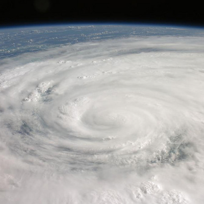
“In southern New England, we should prepare for hurricanes or tropical storms that could produce more heavy rain then we have seen in the past. Usually people think of hurricanes in terms of the wind speed categories. But recent tropical cyclones that made landfall in the U.S. have been more known for rainfall flooding. The past two seasons produced the two wettest storms in 70 years – Hurricane Harvey and Florence,” said Ginis.
“It is important to know the amount of rain in the storm has little to do with maximum winds. In fact, one of the most important factors is the storm’s translation speed. The slower the storm moves the greater potential for heavy rain,” added Ginis. “One recent study found that the average speed of tropical cyclone translation along the North American coast has slowed since the mid 20th century. Other studies indicate that hurricanes now produce more rain because of global warming.”
.jpg)
Ghiorse, who provides his “Ghiorse Factor” on a scale of 1-10 every day on GoLocalProv, said there is still a lot of uncertainty — but that Rhode Islanders should be “vigilant and prepared.”
“This has been a very quiet season so far with only 4 named storms (and weak ones at that) as we head into the heart of the hurricane season,” said Ghiorse. “El Nino, large clouds of Sahara Desert dust and very dry air over the tropical Atlantic have been somewhat responsible for this lack of activity, however, it is likely it will begin to pick up from now into October as the El Nino has diminished and the other factors have lessened as well. “
“Unfortunately, there is no real way to predict whether or not we will be involved to any great degree here in Southern New England. It really depends where future storms form and track and that tends to be very random in nature. Some of our most devastating storms have occurred in quiet seasons overall,” said Ghiorse. “The 'luck of the draw,' so to speak, tends to be the catchphrase when it comes to an individual storm and where and whom it affects. So, all we can do is be vigilant and prepared and hope that Dorian and those to follow will decide to go elsewhere, preferably 'out to sea.' Just don't ever count on it!”