Ghiorse Thursday PM Henri Update: What to Watch For Over Next Couple Days
GoLocal Meteorologist John Ghiorse
Ghiorse Thursday PM Henri Update: What to Watch For Over Next Couple Days
_1.jpg)
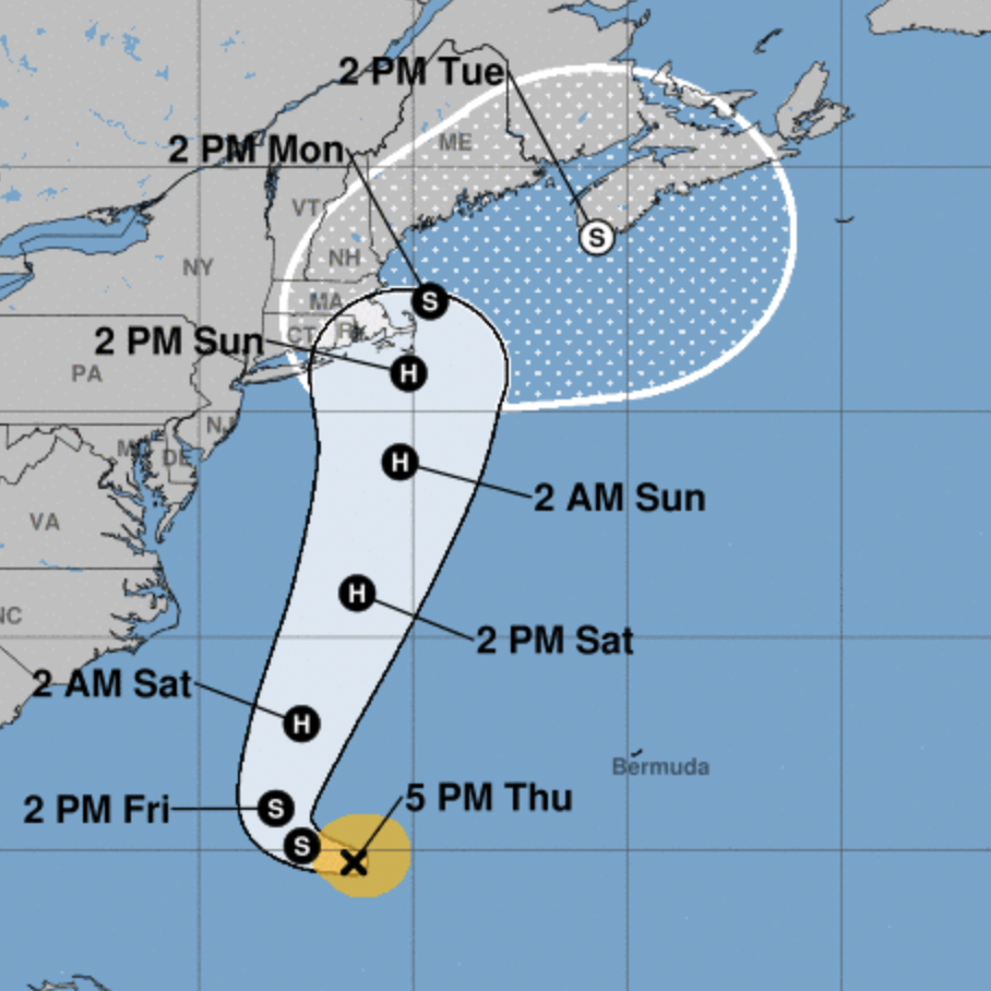
On Thursday morning, the National Hurricane Center said that Henri could strengthen to a hurricane — and said Thursday afternoon it is expected to strengthen on Friday and over the weekend.
Effects of the storm are anticipated to start impacting southern New England Sunday afternoon.
GET THE LATEST BREAKING NEWS HERE -- SIGN UP FOR GOLOCAL FREE DAILY EBLASTSEE MAP BELOW
Ghiorse Update
Ghiorse provided the following update on Thursday.
"This evening Tropical Storm Henri continues to wander slowly westward in the Atlantic some 850 miles south of Rhode Island. It has yet to make a consequential move to the north which it must eventually do.
As is quite common, numerical weather models and other forecasting tools continue to give conflicting answers as to when and where that will happen and, thus, begin to answer the question. 'How close will it come to Rhode Island?'
It does seem likely that Henri will intensify into at least a Category 1 hurricane once it turns northward and begins to accelerate over the warm waters of the Atlantic and Gulf Stream. Most but not all of the guidance brings the storm close to us later Sunday or Monday.
In my mind this is still a toss-up, which means we should begin some preparations. Most already have a plan in mind especially if you live near the water or have a boat. Otherwise, it is still a wait-and-see proposition. I want to see a definite turn to the north before making any further projections."