

Will There Be Better Hurricane Predictions Now, After Major Forecasting Upgrade?
GoLocalProv News Team
Will There Be Better Hurricane Predictions Now, After Major Forecasting Upgrade?
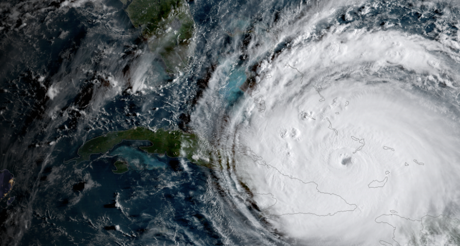
Hurricane season is now here — and next week, there will officially be a new way to track them.
On June 27, forecasters at the National Hurricane Center will start to use the Hurricane Analysis and Forecast System, or HAFS, to scan the Atlantic for possible new storms and to track them if they develop.
GET THE LATEST BREAKING NEWS HERE -- SIGN UP FOR GOLOCAL FREE DAILY EBLAST“Early results are promising. An experimental version of HAFS run for the last three storm seasons was 10 to 15% more accurate on average at predicting the path of a storm than the current best model, the Hurricane Weather Research and Forecast System or HWRF,” reported the Miami Herald this week.
NOAA in May predicted a “near normal” 2023 Atlantic hurricane season.
This "new" way to track storms has been in development by NOAA over the past three years. So what does it entail?
“The last several hurricane seasons have been active with records being set for the number of tropical storms and hurricanes in the Atlantic basin. These record-breaking seasons underscore the importance of accurate hurricane forecasting. Imperative to increased forecasting skill for hurricanes is the development of the Hurricane Forecast Analysis System or HAFS,” according to NOAA. “To accelerate improvements in hurricane forecasting, this project has the following goals:”
1) To improve the HAFS. The HAFS is NOAA’s next-generation multi-scale numerical model, with data assimilation package and ocean coupling, which will provide an operational analysis and forecast out to seven days, with reliable and skillful guidance on hurricane track and intensity (including rapid intensification), storm size, genesis, storm surge, rainfall and tornadoes associated with hurricanes.
2) To integrate into the Unified Forecasting System (UFS). The UFS is a community-based, coupled comprehensive Earth system modeling system whose numerical applications span local to global domains and predictive time scales from sub-hourly analyses to seasonal predictions. It is designed to support the Weather Enterprise and to be the source system for NOAA’s operational numerical weather prediction applications.
The HAFS will be a part of UFS geared for hurricane model applications. HAFS comprises five major components: (a) High-resolution moving nest (b) High-resolution physics (c) Multi-scale data assimilation (DA) (d) 3D ocean coupling, and (e) Observations to support the DA.

“There’s still a lot we don’t know,” Dr. Michael Brennan, Director of the National Hurricane Center said, according to the Herald. “We’re always trying to piece together our best analysis with an incomplete data set.”
"To combat that, NOAA has been steadily rolling out new technology to better understand what goes on inside and around hurricanes, from satellites that can zoom in closer than ever to high-tech 'dropsondes' that hurricane hunters drop from planes inside hurricanes that sample the storm as they fall, sending that data back to forecasters."
This week, GoLocal's meteorologist John Ghiorse provided his insights into what the new model may -- or may not -- mean.
"Early on it was accepted that much of our data was flawed to some extent, so our modeling data out was going to be likewise afflicted," said Ghiorse. "The good news is that the data in problem has seen mega advances and thus the data out has vastly improved along with advances in the computing world.
"This latest modeling approach is the next big step ... instead of modeling a single storm or disturbance, there is a multiple disturbance approach which models multiple disturbances (not all necessarily tropical storms or hurricanes) over a wide area of the tropics," he continued. "It recognizes the real meteorological world that our atmospheric disturbances are not isolated and the keys to being able to realize this in the modeling world are the advancements in computing and data collection.
"So, this new model is a major advancement but probably not the 'end all and be all,' there is still a long way to go," he added. "But this 'new' approach (it obviously has been under development for years) is the next big step. Obviously, the atmosphere is so very complex that any absolute solution may never be achieved."