Up to a Foot of Snow Possible Starting Monday in RI, According to National Weather Service
GoLocalProv News Team
Up to a Foot of Snow Possible Starting Monday in RI, According to National Weather Service
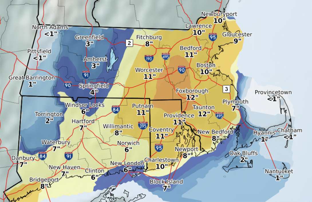
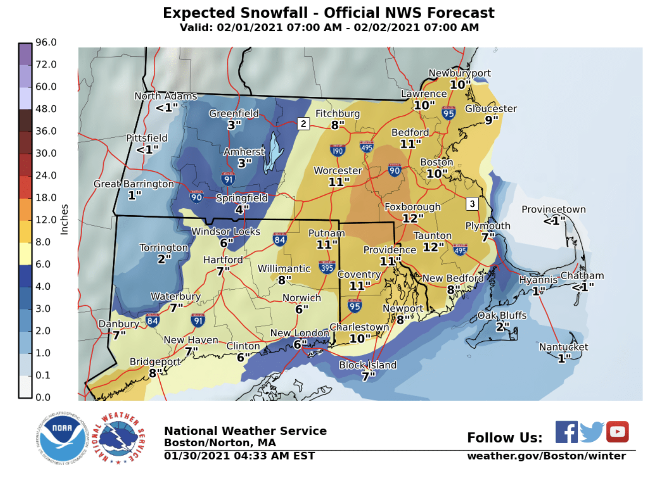
According to NWS, Rhode Island could see snow totals from seven inches on Block Island, to a foot in the northern parts of the state.
The heaviest time of the snowfall is expected to be Monday afternoon through Monday night.
GET THE LATEST BREAKING NEWS HERE -- SIGN UP FOR GOLOCAL FREE DAILY EBLASTMost of the state is expected to see between ten and eleven inches.
SEE LARGER MAP BELOW
The NWS provided the following forecast Saturday morning:
Today: Sunny, with a high near 22. Wind chill values as low as -3. Northwest wind 8 to 10 mph.
Tonight: Clear, with a low around 4. Wind chill values as low as -4. Northwest wind 6 to 8 mph.
Sunday: Increasing clouds, with a high near 27. Wind chill values as low as -5. Northwest wind around 5 mph becoming calm in the morning.
Sunday Night: Mostly cloudy, with a low around 18. Calm wind becoming northeast around 6 mph after midnight.
Monday: Snow likely, mainly after 4pm. Cloudy, with a high near 34. Northeast wind 8 to 17 mph, with gusts as high as 29 mph. Chance of precipitation is 60%. New snow accumulation of 3 to 5 inches possible.
Monday Night: Snow. The snow could be heavy at times. Low around 29. Northeast wind 16 to 18 mph, with gusts as high as 38 mph. Chance of precipitation is 80%. New snow accumulation of 6 to 10 inches possible.
Tuesday: Snow likely, mainly before 2pm. Cloudy, with a high near 33. North wind 16 to 18 mph, with gusts as high as 33 mph. Chance of precipitation is 70%.
Tuesday Night: A chance of snow before 9pm. Mostly cloudy, with a low around 24. Northwest wind 10 to 14 mph, with gusts as high as 24 mph. Chance of precipitation is 30%.