

UPDATE: Midday Thursday- Winter Storm Intensifying in Rhode Island
John Ghiorse, GoLocalProv Meteorlogist
UPDATE: Midday Thursday- Winter Storm Intensifying in Rhode Island
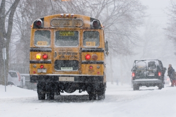
While an earlier forecast called for light snow this morning, most of us woke up to a blanket of white, making for a slick morning commute.
The snow will continue during the midday hours of Thursday, but should be light and fluffy, continuing to accumulate anywhere from an additional inch to a few inches. The snow may stop and start through the day as the main coastal low center has yet to form and intensify.
GET THE LATEST BREAKING NEWS HERE -- SIGN UP FOR GOLOCAL FREE DAILY EBLASTThat will take place tonight.
Snow should become heavy along with blowing and drifting through the night and gradually wind down tomorrow morning. Accumulations still look to be in the 8"+ range with double digits quite likely, especially in Rhode Island and Southeastern Massachusetts.
Temperatures are another issue. Readings should drop steadily tonight into the single digits by morning -- and wind chill values during and after the storm will plunge well-below zero.
13 Biggest Food Stories in RI in 2013

13 Rhody's Best Burger
The culinary experts at Zagat named each state's best burger in its 50 States, 50 Burgers awards, and Providence's Harry's Bar & Burger took the prize in the Ocean State for its sliders. Haven't tried them? Stop in for one… well actually, they come in twos or threes.

12 James Beard Awards
Two high-profile chefs in Rhode Island, Farmstead's Matt Jennings and Champe Speidel of Persimion in Bristol, were named semi-finalists for the prestigious James Beard Foundation 2013 awards in the category of "Best Chef: Northeast". The James Beard awards are considered by many to be the "Oscars" of the culinary world.
Another Ocean State restaurant, Cook & Brown Public House in Providence, was also named as a semi-finalist for its bar program.

11 Best Pizza in America
Providence's Al Forno made The Daily Meal's list of the "Best 101 Pizzas in America," coming in at #10 overall (#3 in New England).
Despite this national accolade, Al Forno was left off the list of Rhode Island's Best Pizza Joints, compiled by GoLocalProv food experts, Ann and Michael Martini.

10 Cooking for the Pope
Master Chef Walter Potenza cooked at the Vatican for Holy Father Pope Francis in November. The event was part of a fund-raising collaboration between the Association of Professional Italian Chefs of the Region of Lazio, and the Hunger-Relief Mission of the Vatican toward the “Barrios” of South America. Potenza was the only chef from the United States to participate.

9 Most Romantic Dining
Three Rhode Island restaurants, Newport's The Spiced Pear and Restaurant Bouchard as well as Basil's of Narragansett, were named by OpenTable in their list of Top 100 “Most Romantic” Restaurants in the US.

8 Ben Sukle's Birch
Johnson and Wales graduate chef Ben Sukle once worked in what many consider to be the world's best restaurant, Copenhagen's Noma. After returning to Providence and the kitchens of La Lattiere and the Dorrance, the culinary master opened his own downtown eatery, Birch, across from Trinity Rep in 2013.

7 #2 Ice Cream City
Providence was named by Travel + Leisure Magazine as the 2nd Best Ice Cream City in America in their July issue. Whether you prefer the great gelato available on Federal Hill, or the hipster favorite PVD Pops ice cream cart, Providence certainly has its finger on the pulse of frozen treats.

6 Food Trucks
Some argue that the food truck craze started in Providence, with the 1888 establishement of Haven Bros. In 2013, Providence saw the opening of a food truck park on the city's West End.
See Ann + Michael Martini's list of the best food trucks in New England here.

5 Foolproof Brewing
Rhode Island's newest craft brewery hit the scene in 2013, and they hit the ground running. Nick Garrison caught the brewing bug after getting a home-brew kit for Christmas, and went on to craft the beer for his own wedding. He then teamed up with professional brewer Damase Olsson to start the Foolproof Brewery, which quickly became a favorite among Rhode Islanders.

4 America's Best Taco
Providence showed off its diverse mixture of high-quality dining options when Olneyville's La Lupita Tacos Mexicanos was named by the Huffington Post as one of The Best Tacos in America in March.
See Ann + Micheal Martini's picks for the best Mexican food in RI here.

3
Carolyn's Sakonnet Vineyard
Alex + Ani's Carolyn Rafaelian purchased Sakonnet Vineyards in late 2012. And in 2013, the new ownership released its first wine, Blessed Blend, to positive reviews. A great year kept getting better for the Little Compton vineyard when the Boston Celtics named Carolyn's Sakonnet Vineyards as its official Team Wine.

2 America's Best Bakeries
With great coffee, and even better breads and pastries, it is not uncommon to see lines stretching out the door at Providence's Seven Stars Bakery. Which is why few were surprised when The Daily Meal named them as one of the America's 50 Best Bakeries in 2013.
GoLocalProv Food experts Ann + Michael Martini certainly agreed, as they included the bakery's Rumford location in their list of Rhode Island's Best Bakeries back in January.

1 Health Code Violations
Not all of Rhode Island's food stories in 2013 were good news. In 2013 GoLocalProv went through the health inspection records for Providence-area dining establishments and unveiled a list of the worst offenders.
Two of the restaurants had more than 30 violations each, with many others racking up numerous trangressions each. The violations range from minor observations to the more serious; including cross-contamination, lack of proper food storage, employees not wearing gloves when handling ready-to-eat food, hand washing, or sick employees at work.
See the full list of violators here.


