

Winter Storm Watch Issued - 4 to 10 Inches of Snow Now Possible Friday
GoLocalProv News Team
Winter Storm Watch Issued - 4 to 10 Inches of Snow Now Possible Friday
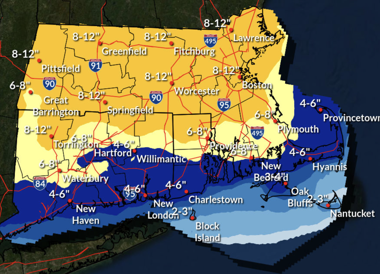
In total, parts of the region could see as much as four to ten inches of snow.
URGENT - WINTER WEATHER MESSAGE
National Weather Service Boston/Norton MA
300 AM EST Wed Feb 23 2022
CTZ002>004-MAZ017>019-RIZ001>004-232100-
/O.NEW.KBOX.WS.A.0008.220225T0500Z-220226T0500Z/
Hartford CT-Tolland CT-Windham CT-Northern Bristol MA-Western Plymouth MA-Eastern Plymouth MA-Northwest Providence RI-Southeast Providence RI-Western Kent RI-Eastern Kent RI-
Including the cities of Hartford, Windsor Locks, Union, Vernon, Putnam, Willimantic, Taunton, Brockton, Plymouth, Foster, Smithfield, Providence, Coventry, West Greenwich, East Greenwich,
Warwick, and West Warwick
...WINTER STORM WATCH IN EFFECT FROM LATE THURSDAY NIGHT THROUGH
FRIDAY EVENING...
* WHAT...Heavy snow possible. Total snow accumulations of 4 to 10
inches possible.
* WHERE...Portions of northern Connecticut, southeastern
Massachusetts and northern Rhode Island.
* WHEN...From late Thursday night through Friday evening.
* IMPACTS...Travel could be very difficult. Friday morning
commute will likely be impacted, and possibly the evening
commute.
* ADDITIONAL DETAILS...Snowfall rates of an inch per hour or
greater will be likely for a period of time.
PRECAUTIONARY/PREPAREDNESS ACTIONS...
Monitor the latest forecasts for updates on this situation.
&&
$$