

Hurricane Irene ... Monday Evening Update
John Ghiorse, GoLocalProv Meteorologist
Hurricane Irene ... Monday Evening Update
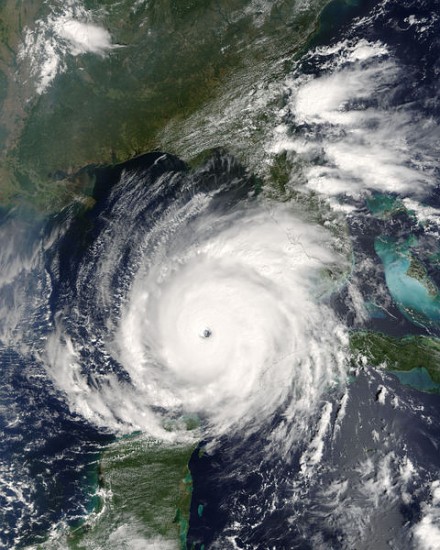
This evening Irene is now a category 2 hurricane with top sustained winds of 100 mph with higher gusts and continues to intensify slowly and could become at major hurricane (category 3 or higher) as it moves into the Bahamas in the next couple of days. Early this evening it was located about 65 miles north of the northern coast of the Dominican Republic. Irene is moving WNW at 12 mph and should maintain that course into tomorrow and then gradually begin to turn more to the northwest. That turn should lessen the threat to Florida and increase the threat to the Carolinas and perhaps points farther north, including Southern New England.
However, we all should remember that this storm is still well over 1500 miles from Providence and is not expected to draw close to any area along the East Coast until very late this week. So, while all of us should keep posted on the latest movement and forecast track for Irene, there is no need for undue concern or special preparations at this time. You can continue to follow the storm on our super Stormpulse HurricaTracker…https://www.golocalprov.com/index.php/weather/ . I will, of course, continue to update you throughout the week.