

Hurricane Irene ... Saturday Evening Update
John Ghiorse, GoLocalProv Meteorologist
Hurricane Irene ... Saturday Evening Update
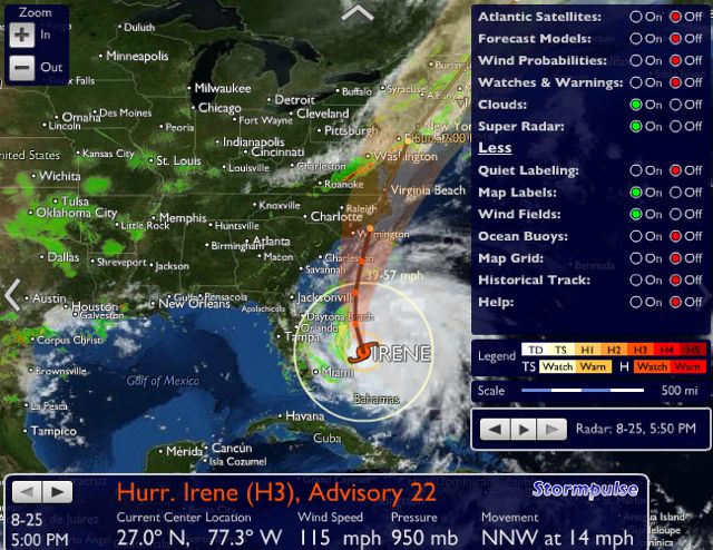
We should see wind and rain increase early Sunday morning with a potential for winds of 50-60 mph with perhaps a few gusts to hurricane force in the late morning or early afternoon. Rainfall should total 3-5 inches and that will lead to some local flooding but the greatest rainfall should occur well to our west. The storm should wind down quickly tomorrow evening.