

Hurricane Irene ... Thursday Evening Update
John Ghiorse, GoLocalProv Meteorologist
Hurricane Irene ... Thursday Evening Update
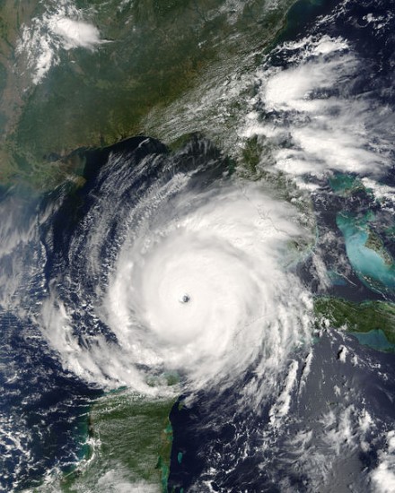
As of this evening Irene is still over 1000 miles from Providence and about 575 miles south of Cape Hatteras, North Carolina. The Category 3 storm with peak sustained winds of 115 mph with higher gusts is moving just slightly west of due north at 14 mph and is expected to impact the North Carolina coast beginning sometime tomorrow and extending into Saturday. Hurricane Warnings are already up for that area.
Later Saturday and Sunday Irene’s eye is expected skirt right up the coastline heading close to New York City by late Sunday. If that happens, Irene is likely to lose some strength due to its interaction with land and also it will begin to outrun its fuel supply … warm, tropical ocean water. Irene is such a large storm that we should still see very strong, perhaps hurricane force wind gusts along with heavy, squally rains. However, a jog in that track 50 miles farther east would put us right back in the near direct hit category. So, we certainly still need to keep on high alert for the very latest with this dangerous storm. I’ll have further updates and continue to follow Irene with our super Stormpulse Hurricane Tracker … https://www.golocalprov.com/index.php/weather/