

Flood Watch Issued for RI: Several Inches of Rain, Wind Gusts Over 40 MPH Possible
GoLocalProv News Team
Flood Watch Issued for RI: Several Inches of Rain, Wind Gusts Over 40 MPH Possible
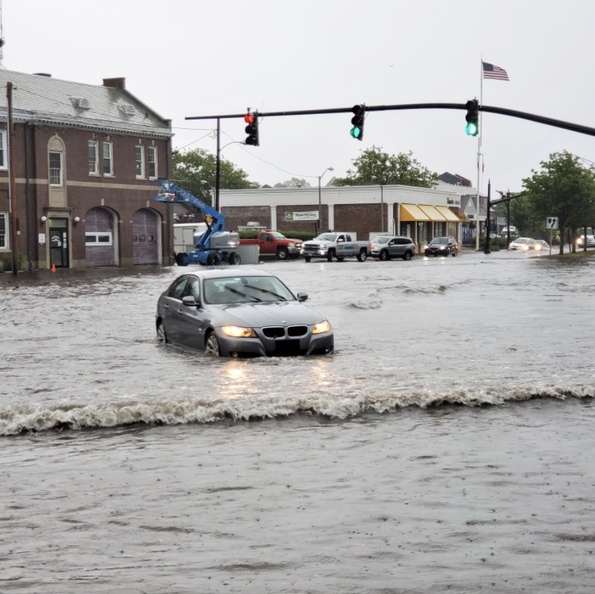
According to NWS, several inches of rain including thunderstorms are possible over the 24-hour period, and wind gusts of up to 43 mile-per-hour are in the forecaset for Monday morning.
A coastal flood watch has also been issued.
GET THE LATEST BREAKING NEWS HERE -- SIGN UP FOR GOLOCAL FREE DAILY EBLAST
Today: Rain, with thunderstorms also possible after 3pm. Patchy fog. High near 61. Breezy, with a south wind 5 to 10 mph increasing to 15 to 20 mph in the afternoon. Winds could gust as high as 30 mph. Chance of precipitation is 80%. New rainfall amounts between a tenth and quarter of an inch, except higher amounts possible in thunderstorms.
Tonight: Rain, with thunderstorms also possible after 11pm. Some of the storms could produce heavy rainfall. Patchy fog. Steady temperature around 60. Windy, with a south wind 22 to 29 mph, with gusts as high as 44 mph. Chance of precipitation is 100%. New rainfall amounts between 1 and 2 inches possible.
Monday: Rain and possibly a thunderstorm before 1pm, then a slight chance of rain between 1pm and 2pm. Some of the storms could produce heavy rainfall. Patchy fog before 1pm. Temperature falling to around 42 by 5pm. Windy, with a south wind 21 to 29 mph becoming west in the morning. Winds could gust as high as 44 mph. Chance of precipitation is 100%. New precipitation amounts between 1 and 2 inches possible.
Monday Night: Mostly clear, with a low around 28. Breezy, with a west wind 15 to 20 mph decreasing to 9 to 14 mph after midnight. Winds could gust as high as 32 mph.
Tuesday: Sunny, with a high near 42. West wind 6 to 9 mph.