HURRICANE UPDATE 7PM: Rhode Island To See Winds Up to 70MPH
John Ghiorse, GoLocalProv Meterologist
HURRICANE UPDATE 7PM: Rhode Island To See Winds Up to 70MPH

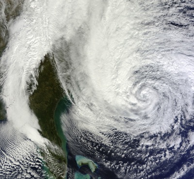
Sandy's current location
Early this evening Sandy was located just under 600 miles south of Providence, moving northeast around 15 MPH. Most of the weather forecasting mathematical models have consolidated on a track that will continue to move Sandy on its current course tonight with a gradual turn to the left, toward the East Coast tomorrow. The eventual landfall of the center should be tomorrow night along the New Jersey coast. But as previously stated this storm covers a very large area and dangerous weather conditions exist over a few hundred miles from the storm center.
Rhode Island: Big winds and flooding
It looks like we can expect to see wind gusts in the range of 40-70 mph much of tomorrow afternoon and evening along with severe shoreline and beach battering. Widespread power outages are likely. A tidal storm surge of 3-5 feet late tomorrow and tomorrow evening likely will cause considerable flooding along the coast and around Narragansett Bay. Tides are high between 8 and 9 PM. We will see bands of heavy rain but the heaviest rain should occur to our west through New York and New Jersey.
GET THE LATEST BREAKING NEWS HERE -- SIGN UP FOR GOLOCAL FREE DAILY EBLASTAll your preparations for the storm should be complete at this time. I will continue to update you throughout the storm.

