

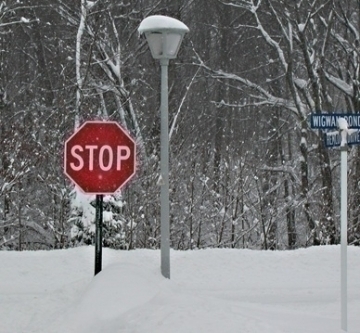
John Ghiorse: Storm Update - Wednesday Night
John Ghiorse, GoLocalProv Meteorologist
John Ghiorse: Storm Update - Wednesday Night
If that track (and it's a big IF) holds true then the Mid-Atlantic states will get a mega-snowfall (1-2ft.) but we will be on the northern fringe of the accumulating snow with a very sharp drop off in accumulation with the most being along the south coast and less progressing northward. Very little, if any, accumulation would be anticipated in the northern 3 states.
Given that we are still 2-3 days away from the potential storm, I can't put any meaningful numbers for snow accumulation but they would be much less than the 1-2 feet anticipated in the Mid-Atlantic. Of course, if the storm tracks closer a total revamping of the above would be in order. Sit tight this will continue to be a nail-biter.
GET THE LATEST BREAKING NEWS HERE -- SIGN UP FOR GOLOCAL FREE DAILY EBLASTLatest From the National Weather Service

The percentage increases on Saturday with a 60% chance of snow during the day and a 70% chance of snow at night.
The weekend concludes with a 40% chance of snow on Sunday.
25 Things to do Before it Snows

Take a Stroll on Narragansett Beach
While it's likely too cold to go in the water, the weather is perfect for an early evening stroll a long the water.
Maybe even take your shoes off and enjoy the sand.

Run/Walk alongside the Charles River
Head to Boston, park the car, and take run or a walk along the Charles River before its turns to an ice rink in a few weeks.
It will happen quickly so don't wait too long.
Photo courtesy of thecharles.org

Providence Waterfire - Nov. 7th
This is the last waterfire of 2015 so if you have yet to get to one this year, plan to go to this one.
Waterfire will pay tribute to veterans who have served the country with a number of special ceremonies, fairs and other activities. You don't want to miss this Waterfire.
For more information, click here.

Final Golf Swings of the Season
The prime time for golf is of course over but with this warm weather get the clubs back out of storage and head to your club or nearest public course and get some final swings in before the season is really over.
Hit them straight!

Rock Climbing at Purgatory Chasm
Go for a end of season adventure to Purgatory Chasm just off of Rte. 146 and do some rock climbing. Purgatory Chasm has 10 different climbing options, if you get bored on one, just go to the other one.
Just be careful while your doing it.
Click here for more information

Cook Out
Give yourself a break from the kitchen, because lord knows you may be there a lot over the next few months, and head out side, invite some friends and family over and light up the grille.
Enjoy it while you can.

Go Shirtless to a Patriots Game
It's football season and the New England Patriots are on roll early on. Show your team spirit and go to game shirtless before it gets too cold.

Stroll through Norman Bird Sanctuary in Middletown
Take a break from the stress of the upcoming winter season and head to Norman Bird Sanctuary in Middletown for a pleasant stroll.

Have a cocktail on the patio at Ceres Bistro at the Beechwood Hotel in Worcester
Outdoor dining is getting tougher and tougher but right now seems to be a perfect stretch of weather to sit out side and have a cocktail or even dinner if you choose.
Savor this because in just a short time, dinning will only be indoors.
For more information, click here.

Take a Walk on Newbury Street in Boston
Stroll down Newbury Street in Boston's back bay and get some shopping in or dine out at one of the many restaurants before the snow hits.
Photo courtesy of Rudi Riet/flickr

Bike at the East Bay Bike Path
If walking and running doesn't do it for you, grab your bike out the garage and ride down the East Bay bike path for some solid excerise.
Treasure riding a bike and actually going somewhere because once the snow hits, it's going to be stationary bikes inside a gym.

Veterans Memorial 5K Road Race in Worcester
Do you think you have one more race in you this season? Make it the Veterans Memorial 5K Road Race in Worcester taking place Saturday, November 7th.
The race begins at 9 a.m.
Click here for more information.
If you can't make it to this race, be sure to get out to another one before this nice weather fades

Grafton Flea Market
With the winter months coming, you might want to stock up on extra clothes or some other cool things to keep you entertained. Get to the Grafton Flea Market for some awesome bargains, and cool merchandise.
The Flea Market is located at 296 Upton Street in Grafton
Click here for more information.

Roger Williams Park Zoo
While the Zoo never closes for the winter, it's a bit tougher to get there in the snow and certainly less enjoyable in the frigid weather.
So take advantage of this nice weather and go visit the zoo.
The animals will appreciate if you do.
Click here for more information.

Hike at Becket Land Trust Historic Quarry and Forest in The Berkshires
The quarry and forest offers extensive hiking trails, providing great workouts for those hiking them as well as spectauclar views and just a relaxing hike for all.
The trails are open from dawn to dusk.
Click here for more information.

Visit Newport Vineyards
The prime grape season is winding down and so is the amount of time left to take a stroll through Newport Vineyards.
You don't want to miss out and have to wait till next season, do you?
Click here for more information.

Walk/Jog/Hike Through the Bird Sanctuary
There are some great walking and hiking paths behind the Audubon Society on Massasoit Road in Worcester to visit this fall.
Want to be at peace and escape the city without really leaving the city? Take a brisk walk through the Bird Sanctuary. If you don't feel better by the time you leave there...then turn around and go back in.
The bird sanctuary is located on 414 Massasoit Road in Worcester

Go Fishing
Use up the last of your worms, lines and whatever else you have left over from the fishing season and get that boat back out while your at it.
It's 60 degrees and it's time to fish.
Enjoy this bonus fishing time and hopefully you catch something big.

Colt State Park Half Marathon in Bristol
Are the competitive juices still flowing? Looking for a solid run to cap off your summer/fall season, join in the Colt State Park Half Marathon on Sunday, November 8th.
The 10K race starts at 9 a.m. and the 5K race starts at 9:30 a.m.

Final Outdoor Tennis Matches
Of course you can play tennis inside during the winter but for outdoor tennis matches, this will likely be about it.
Take your last cracks on the outdoor court, maybe build some momentum for the indoor season.

Cruise
Take the nice car out of the garage, get back on the motor cycle or just simply open the sun roof and roll the windows down and cruise around town during this great weather.

Take Your Dog for a Walk
Let's face it, dogs don't really care that much if there is no snow on the ground or 5 feet of snow on the ground. When they want to go for a walk, they want to go for a walk.
At least you can enjoy this walk in this warm weather. They will soon become torturous.

End of Season Yard Work
While it's not the most fun thing in the world to do, sometimes it just has to be done. Get the yard ready for the winter.
You never know when you will see the grass again.
Photo courtesy of Leonard Moorehead, the Urban Gardener

Go Outside
If you don't do anything from the above list, at least go outside and hang out, throw a baseball or football around or sit outside and read a good book.
Could be a long winter indoors so enjoy the outdoors no matter what.

Why no New Hampshire, Maine or Vermont?
Here at GoLocal, we love New Hampshire, Maine and Vermont. We do.
It's just hard to believe it's going to be 60 degrees there.


