

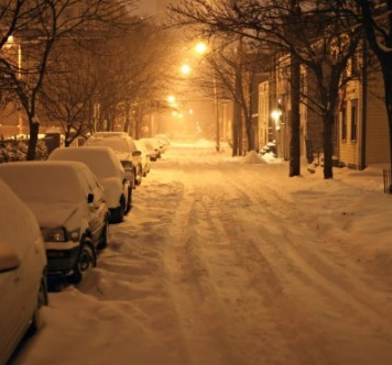
John Ghiorse: Storm Update - Thursday
John Ghiorse, GoLocalProv Meteorologist
John Ghiorse: Storm Update - Thursday
Most of the latest data is trending to a farther south track and if this holds over the next day or so, snow-lovers here in Southern New England will not be happy. Right now, it looks like we will see anywhere from nothing to a few inches with the greatest chance for snow along the south coast from Westerly to New Bedford and Cape Cod. Amounts should diminish farther north into Providence with much less to virtually nothing farther north toward Worcester and Northern Massachusetts.
We still have a couple of days to go and this could all change. It's far too early to write this off altogether but the trend is setting in and I will continue to watch for any indications to the contrary.
GET THE LATEST BREAKING NEWS HERE -- SIGN UP FOR GOLOCAL FREE DAILY EBLASTLatest From National Weather Service

On Saturday night, there is a 40 percent chance of snow before 4 a.m.
Sunday is partly sunny.
Things You Need to Know Before the Next Blizzard - 2016

Is Your Car Ready
Is your car ready for the Blizzard?
Assemble a Winter Emergency Car Kit Checklist (see below)
Keep your gas tank at least half-full to prevent your fuel line from freezing.
Install good winter tires with adequate tread and pressure.
Check your antifreeze, battery, defroster, windshield wipers, wiper fluid, and other vehicle equipment to make sure they are ready for winter driving.

Auto Checklist
Assemble a Winter Emergency Car Kit Checklist
Your winter emergency car kit should include:
Flashlight with extra batteries
Charged cellphone and automobile charger
Basic first aid kit
Necessary medications
Pocket knife
Blankets or sleeping bags
Extra clothes (including rain gear, boots, mittens, socks)
High-calorie non-perishable foods (dried fruits, nuts, canned food)
Manual can opener
Container of water
Windshield scraper and brush
Fire extinguisher
Shovel Sand, road salt, or cat litter for traction
Tire chains or traction mats
Basic tool kit (pliers, wrench, screwdriver)
Tow rope
Battery jumper cables
Road flares/reflectors
Brightly colored cloth to use as a flag

Fall through the ice
Do not go out onto the ice to try to rescue a person or pet.
Reach-Throw-Go:
Try to reach the victim from shore. Extend your reach with a branch, oar, pole, or ladder to try to pull the victim to safety.
If unable to reach the victim, throw them something to hold onto (such as a rope, jumper cables, tree branch, or life preserver).
Go for help or call 911 immediately.
If you fall in, use cold water safety practices:
Try not to panic.
Turn toward the direction you came from and place your hands and arms on the unbroken surface, moving forward by kicking your feet.
Once back onto unbroken ice, remain lying down and roll away from the hole.
Crawl back toward land, keeping your weight evenly distributed.
If you can’t get back on the ice, use the Heat Escape Lessening Position (HELP):
Bring your knees up toward your chest.
Cross your arms and hold them close to your body.
Keep your legs together.
Try to keep your head out of the water.
Do not try to swim unless a boat, floating object, or shore is close by. Swimming in cold water cools your body and reduces survival time.

Pets Indoor
If it’s too cold for you, it’s probably too cold for your pets. Don’t keep your pets outdoors for long periods of time during very cold weather. Short-coated dogs may need a coat or sweater during walks

If outdoors
If you have outdoor dogs, make sure they have a dry, draft-free doghouse that:
Is large enough for pets to sit and lie down in, but small enough to retain their body heat.
Has a floor that is elevated a few inches off the ground and is covered with cedar shavings or straw.
Has an entrance that faces away from heavy winds and is covered with a flap of heavy waterproof fabric or heavy plastic.

Salt and feet
Salt and other chemicals used to melt ice and snow can harm your pet’s feet.
Gently rub the bottom of your pet’s paws with a damp towel to remove these irritants after a walk, or buy dog boots to prevent paw irritation during winter weather.
You should also look for signs that your pet’s feet are uncomfortably cold, which could include them frequently lifting up their paws, whining, or stopping.

Roof Snow
Do's
Use a snow rake (available at most hardware stores) to remove snow from pitched roofs.
Start from the edge and work your way up the roof.
Try to shave the snow down to 2 or 3 inches on the roof instead of scraping the roof clean, which will risk damage to your shingles or other roof covering.
Keep all ladders, shovels, and roof rakes away from utility wires.
Plastic shovels are usually best. Metal tools may cause damage to your roof.
Shovel snow from flat roofs by throwing the snow over the side away from the building.
Carefully remove large icicles if they're hanging over doorways and walkways.
Wear protective headgear and goggles when performing any of these tasks.
Have someone outside with you to assist.
Keep gutters and drains clean and free of ice, snow, and other debris, and keep downspouts clean at ground level.

Roof Snow
Don'ts
Don’t stand on or place heavy equipment on the roof unless approved by a registered professional engineer.
Don’t use a ladder, since ice tends to build up on both the rungs of the ladder and the soles of your boots. If using a ladder, be extra cautious during cold and icy weather.
Don’t use blow torches, open flames, or electric heating devices like hair dryers or heat guns to remove snow and ice.
Don’t try to remove ice or icicles from utility wires or meters. Call your utility company for assistance.

Extreme Cold Home
Don’t stand on or place heavy equipment on the roof unless approved by a registered professional engineer.
Don’t use a ladder, since ice tends to build up on both the rungs of the ladder and the soles of your boots. If using a ladder, be extra cautious during cold and icy weather.
Don’t use blow torches, open flames, or electric heating devices like hair dryers or heat guns to remove snow and ice.
Don’t try to remove ice or icicles from utility wires or meters. Call your utility company for assistance.


