

John Ghiorse: Storm Update - Thursday, Feb. 4
John Ghiorse, GoLocalProv Meteorologist
John Ghiorse: Storm Update - Thursday, Feb. 4
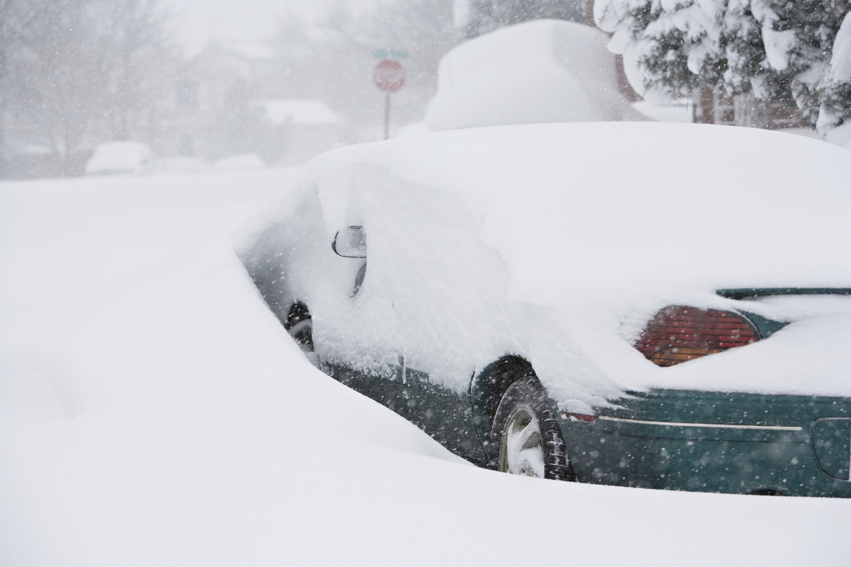
The mild air we've had around lately will depart overnight as a low pressure forms along the cold front and races by us and off shore tomorrow. This looks like a messy affair with rain to start tonight but likely changing to a heavy, wet snow first well inland during the wee morning hours and eventually spreading to coastal communities during the early morning. The morning commute in the Worcester and Providence areas probably won't be much fun (are they ever?). While accumulations won't be massive at that time, the roads could be quite greasy. Shoveling this stuff probably won't be fun either. The whole thing should wind down late in the day and end tomorrow evening.
GET THE LATEST BREAKING NEWS HERE -- SIGN UP FOR GOLOCAL FREE DAILY EBLAST

National Weather Service Warning
SIGNIFICANT SNOWFALL POSSIBLE ACROSS PARTS OF SOUTHERN
NEW ENGLAND LATE TONIGHT INTO FRIDAY...
NORTHERN BRISTOL MA-WESTERN PLYMOUTH MA-EASTERN PLYMOUTH MA-
SOUTHERN BRISTOL MA-SOUTHERN PLYMOUTH MA-BARNSTABLE MA-DUKES MA-
SOUTHEAST PROVIDENCE RI-EASTERN KENT RI-BRISTOL RI-WASHINGTON RI-
NEWPORT RI-BLOCK ISLAND RI-
INCLUDING THE CITIES OF...TAUNTON...BROCKTON...PLYMOUTH...
FALL RIVER...NEW BEDFORD...MATTAPOISETT...CHATHAM...FALMOUTH...
PROVINCETOWN...VINEYARD HAVEN...PROVIDENCE...WARWICK...BRISTOL...
NARRAGANSETT...WESTERLY...NEWPORT...BLOCK ISLAND
1145 AM EST THU FEB 4 2016
...WINTER STORM WATCH REMAINS IN EFFECT FROM LATE TONIGHT THROUGH
FRIDAY AFTERNOON...
* LOCATIONS...PORTIONS OF RHODE ISLAND AND SOUTHEAST
MASSACHUSETTS.
* HAZARD TYPES...HEAVY SNOW.
* ACCUMULATIONS...POSSIBLE SNOW ACCUMULATION OF 4 TO 7 INCHES.
* TIMING...RAIN DEVELOPS TONIGHT AND CHANGES TO SNOW FRIDAY
MORNING. HEAVY SNOW IS POSSIBLE DURING THE FRIDAY MORNING
COMMUTE WITH SNOWFALL RATES UP TO ONE INCH PER HOUR.
* IMPACTS...THE FRIDAY MORNING COMMUTE WILL BE MOST AFFECTED DUE
TO HAZARDOUS DRIVING CONDITIONS. WET SNOW ACCUMULATING ON TREES
AND POWER LINES COULD RESULT IN ISOLATED POWER OUTAGES.
PRECAUTIONARY/PREPAREDNESS ACTIONS...
A WINTER STORM WATCH IS MEANS THERE IS THE POTENTIAL FOR MORE THAN
SIX INCHES OF SNOW. STAY INFORMED. PLAN ON A SLOWER THAN USUAL
COMMUTE FRIDAY MORNING...OR TELECOMMUTE IF POSSIBLE.
25 Things to do in New England This Winter - 2016

Newport, Rhode Island
From February 12 to 21, Newport will be hosting the 28th annual Newport Winter Festival throughout Newport County. Hosting events like Beatlemania, chili cook-off, the Winter Festival is 10 days of music and over 150 events, providing fun for the entire family.
Photo courtesy of Newport Winter Festival

Dog Sled Tours at New England Dog Sledding
Mason Township, Maine
Embrace the call of the wind and head to New England Dog Sledding for some dog sled tours. Tours are pulled by trained and "very friendly" Alaskan Husky sled dogs and are offered throughout the Bethel, Maine and North Conway,New Hampshire areas. You can also enjoy skijoring, which is nordic skiing pulled by a dog, so you can bring your own or rent one of theirs!

Curling at Ocean State Curling Club
Cranston RI
Try something new, like curling.
The Ocean State Curling Club has your curling fix. Hosting events and tournaments or "bonspiels" at the Veteran’s Memorial Ice Rink in Cranston, RI, the Ocean State Curling Club is a "social club for anyone interested in recreational curling." The club also offers lessons for those who want to learn the sport.
Photo: dave/Flickr

Shrewsbury, MA
Go tubing, skiing or snowboarding on the different terrains of Ski Ward.
New to the mountain? You can learn how to ride with lessons from their instructors or perfect your technique if you happen to be more experienced. And don't forget to take the whole family out to Slope side Bar and Grill after a long day in the snow.
Photo: Ski Ward

Ice Fishing
It's practically a tradition for a lot of people but ice fishing is an interesting winter experience. Head out to the ponds and see what you can get.
But be safe, it takes 4-6 inches of ice to support a person and 8-10 inches to support a vehicle.
Photo courtesy of Dushan Hanuska/flickr

Ice Climbing with Adventure Spirit
Burlington, Vermont
For the adventurous out there, Adventure Spirit in Vermont is your place for ice climbing. Choose from climbing at Bolton Quarry, Bristol Cliffs or even Smuggler's Notch to be lead by one of their experienced instructors. Be prepared to spend your day strenuously climbing some of nature's frozen streams and flow offs. They also offer alpine climbing and outdoor rock climbing for those who wish to fully test their limits.
Photo: Daniel/Flickr

Cross Country Skiing
East Bay Bike Path, Bristol to Providence RI
Grab your poles and skis and head down to the East Bay Bicycle Path for some Cross Country Skiing. Of course, you can go cross country skiing anywhere there is snow and some flat land, but the East Bay Bike Path stretches about 14 miles from Bristol to India Point Park in Providence.

Lowell, MA
The 16th Annual Lowell Winterfest is set to take place on February 19 and 20th.
The schedule f events includes free ice skating, an opening ceremony and a big winter carnival that the kids will simply love.
Ice Sculptures, a fire dance and a city hall lighting also highlight the festival.
Photo: Mike/Flickr

Go Snowshoeing
For those who can't ski or snowboard, snowshoeing is another way to get around in the snow. Vermont, Maine and New Hampshire ski resorts have designated snowshoeing facilities, but the best part is you can strap into a pair and walk around anywhere snow is too deep for boots.

Sledding in RI
Winter time means it's time to get the sleds out and find some serious hills to conquer.
Click here for Golocal's most recent list of the best sledding hills in Rhode Island.

Pond Hockey
Lace up the skates, grab your favorite jersey and stick and hit the frozen ponds for some hockey. Maybe just some one on one action or grab a bunch of friends and play a full scale game.
Either way enjoy the ice.
But be safe, But be safe, it takes 4-6 inches of ice to support a person.
Photo courtesy of yooperann/flckr

Take a Nature Walk at Squam Lakes
Holderness, New Hampshire
Squam Lakes Natural Science Center in Holderness, NH offers a wide arrange of guided tours of live animal trails. A staff naturalist leads and teaches groups how certain animals are adapted to the winter climate in New Hampshire. The guided tours are run on weekends and can be a great way to experience and learn more about nature in New England.
Photo: Doug Brown/Flickr

Day and Night Skiing at Wachusett Mountain
Princeton, MA
Make the best of winter by strapping on your skis or snowboard. With over 25 trails open, Wachusett also lights up 18 of these trails until 10pm for night skiing. Wachusett has rentals and lessons for beginners and terrain parks and even an air bag for advanced skiers and boarders. Night tubing is an option during speical events, too!

Pawtucket, RI
Forget about winter by painting a picture of a tropical sunset at Paint and Vino, Rhode Island's first paint and wine studio. Bring children for family paint events and parties, or leave them at home to enjoy complimentary "adult beverages" as you paint. Perfect for date night, girls night out or a fun friday night, Paint and Vino's classes run for 2 1/2 to 3 hours and a spot must be reserved.
Photo: Yelp Inc./Flickr

Providence Winter Restaurant Weeks
Providence Winter Restaurant Weeks will be held until January 23 features about 80 restaurants offering three-course, prix fixe lunches for $14.95 and three-course prix fix dinners for $29.95 and $34.95.
Participating restaurants include Siena in Smithfield, Matunuck Oyster Bar, Eleven Forty Nine Restaurant, The Dorrance, Capriccio, Capital Grille and more.

Providence, Rhode Island
RI native and The Voice veteran Sarah Potenza will be playing a homecoming show on January 24th at The Met
Expect a full show of classics and maybe some tunes from her new album Monster.

Sledding in Central MA
Last year, Central Mass was hit with a record amount of snow. While we are not wishing for that again, it did make for some great sledding hills.
When snow comes again this year, break out the sleds.
Here is GoLocal's latest list of great sledding spots in Central Mass.

Cranston, Rhode Island
The Beach Boys in February? You bet! The touring band led by original member Mike Love (with Newport native John Cowsill on drums) will be stopping by the Park Theatre on Valentine’s Day.

Snowmobiling in Vermont
Mount Snow, Vermont
Snowmobiling across the wilderness is an exhilarating and adventurous experience during the winter.
Be sure to get on a snowmobile at least once this winter.
Photo: Frank Kehren/Flickr

Ice Skating
Whether you are skating on a pond or at one of the many ice rinks across the region like the Alex & Ani rink in the heart of Providence or the ice rink at Worcester Common Oval, make sure to get out there and get a good skate in with friends and family.

Jump Around at Launch Trampoline Park
Need to get some energy out? or get the energy out of your kids? Head to Launch Trampoline Park. They have a park in Rhode Island, Massachusetts and Connecticut.
With dodgeball, basketball, foam pits and more, indoor trampoline parks have something to offer people of all ages. Whether you want to bring a group of children for the day, or sign up a group of adults for some "xtreme" dodgeball, trampoline parks can be a great change of pace and a fun way to try something new.

Indoor Rock Climbing
Do you need a new challenge this winter? Try one of New England's indoor rock climbing gyms. Whether you choose Rock Spot Climbing in Rhode Island, Carabiner's in Massachusetts, or Vertical Dreams in New Hampshire, rock climbing is a fun and challenging way to get some exercise without running on treadmills.
Photo courtesy of Rock Spot Climbing

Give to the Community
While the winter holidays are generally the biggest volunteer days of the year, any day of the year is a great time to give to organizations or people in need. The winter season is sometimes when items like food, clothes, blankets and other things are needed the most.
Click here for how to give back to RI non profits.
Click here for how to give back to Mass non profits.

Get the House Organized
The weather isn't great, it's freezing out side. Winter presents a great opportunity to get the house organized. It's not the most fun thing in the world of course, but it will pay off and at the end of it, you will be glad you did it.
Here are some ways to get organized this winter.

Mount Washington, Bretton Woods New Hampshire
Soar down Mount Washington on a series of tree-top zip lines! The Canopy Tour is lead by one of Bretton Woods Adventure Guides as they describe the native fauna and flora. You'll descend over 1000 feet of elevation on this 3 hour tour. Each tour guide can take a group of up to 8, so grab some friends and zip down the mountain!


