

John Ghiorse: Sunday Night Storm Update
John Ghiorse, Meteorologist
John Ghiorse: Sunday Night Storm Update
We have a winter storm on the way.
Low pressure forming just off the North Carolina coast early this evening will race rapidly past Southern New England by mid-morning tomorrow.
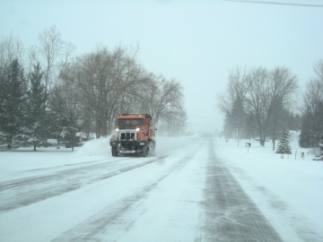
GET THE LATEST BREAKING NEWS HERE -- SIGN UP FOR GOLOCAL FREE DAILY EBLASTHeavy, wet snow will over spread the area from south to north later this evening, become heavy at times overnight into the morning rush and will be pretty much out of here by tomorrow afternoon. It looks like the greatest accumulation will be from Rhode Island south and east to the Cape and Islands with lesser amounts through Central and Western Massachusetts and in ski areas up north.
I'm looking for 6"-10" in Rhode Island and Southeastern Massachusetts with 3"-6" to the west into Connecticut and north into the Worcester area. This stuff will be a load to shovel and push around, typical of early spring snows. Even at this late hour there could still be a shift in the track of the storm center that would change the accumulation forecast. I'll have an update later tonight if that occurs.

14 New England Snow Tubing Spots

Ski Ward
Great for Worcester families, Ski Ward is the perfect destination for everything snow. On any given day, there are over 200 tubes, up to 8 snow tubing lanes in operation, and 2 lifts to bring you back up for another slide down Ward Hill! This year, Ski Ward is celebrating their 75th anniversary, and it’s no secret what has kept them open so long. For a deal, head over on Tuesdays—on the 1st Tuesday of the month tickets are only $7.50 (for their 75th anniversary), and all other Tuesdays tickets will be $19.39 (that’s the year they opened their doors!).
1000 Main Street, Shrewsbury, MA. (508) 842-6346.
Photo: James Emery/Flickr

Yawgoo
Another New England ski area that is celebrating an anniversary this year is RI's Yawgoo Valley Ski Area and Sports Park—they turn 50! Visit Rhode Island’s only ski area to help them celebrate. For only $12, enjoy a 50-minute session of tubing fun! After tubing, head to the snow tubing park’s concession stand to grab a hot chocolate and thaw out!
160 Yawgoo Valley Road, Exeter, RI. (401) 294-3802.
Photo: Massachusetts Office of Travel & Tourism/Flickr

Nashoba Valley
Also turning 50 this year is Nashoba Valley Ski Area in Westford, MA. Open seven days and seven nights all season long, this is the perfect place to get your snow fix. Fly down up to eighteen groomed lanes, serviced by four lifts to minimize wait time. If you need a break to fuel up, visit the onsite snow tubing park lodge, featuring a full bar, TVs, and a warm place to relax.
79 Powers Road, Westford, MA. (978) 692-3033.
Photo: Massachusetts Office of Travel & Tourism/Flickr

Ski Butternut
The Berkshire region of Massachusetts is ideal for a winter getaway. At about an hour and a half drive from Worcester and a two-hour drive from Providence, it is close enough to make a day trip out of it, but the area’s beauty will make you forget you’re so close to home. In the Berkshire town of Great Barrington, you will find Ski Butternut on East Mountain. The price is right for a great tubing experience—only $20 for two hours. This park features 8 tubing lanes, 7 chutes, 200 tubes, an old fashioned handle lift, and 100% snowmaking coverage.
380 State Road, Rte. 23, Great Barrington, MA. (413) 528-2000.
Photo: Alon Banks/Flickr

Amesbury Sports Park
When many people think of northeastern Massachusetts, they think of the beaches and dunes. Well, the town of Amesbury boasts something a little different: Amesbury Sports Park. During the winter, they are 100% dedicated to snow tubing fun on their lanes—the hill is the steepest tubing hill in the state.
12 S Hunt Road, Amesbury, MA. (978) 388-5788.
Photo: Ines Hegedus-Garcia/Flickr

Mount Snow
Vermont is known for their pristine 4-season scenery, their mountains, their maple syrup, and so much more. One winter thrill that is a Vermont do-not-miss is snow tubing! Check out the park at Mount Snow in West Dover. The hill is one of the largest available for snow tubing in the state, and is always covered with plenty of snow, even when there is none in your back yard.
39 Mount Snow Road, West Dover, VT. (802) 245-SNOW.
Photo: John Benson/Flickr

Woodbury Ski Area
Woodbury Ski Area in Woodbury, CT is the largest snow tubing park in all of New England. This place is huge—you get to race down their 20 tubing lanes located in 3 different tubing parks serviced by 4 different lifts. Each park is very different, from terrain to speed and more. If you’re going tubing with a group, ask about their family size tubes!
785 Washington Road, Woodbury, CT. (203) 263-2203.
Photo: Aine D/Flickr

Killington Tubing Park
Killington is another Vermont favorite. Take a cruise down one of the tubing lanes at Killington’s snow tubing park, found right at the heart of this Green Mountain resort. Once you're all snow tubed out, get some R&R at The Clubhouse, where you can grab warm snacks, drinks, pub food, hand-tossed pizza, and more!
4763 Killington Road, Killington, VT. (802) 422-6201.
Photo: Mt. Hood Territory/Flickr

Pats Peak
Every weekend or school break, Pats Peak in Henniker, NH opens up its snow tubing park for business! In order to ride the tubes down the mountain, riders are required to lie on their stomachs, making for a thrilling experience! If you want to try a bit of everything, visit Pats Peak on Saturday night or Martin Luther King Day. For just $48, enjoy skiing, snowboarding, snow tubing, and lesson tips!
686 Flanders Road, Henniker, NH. (603) 428-3245.
Photo: BaileyPalBlue

Berkshire East
Berkshire East in Charlemont is another Berkshire gem. Enjoy 2 hours of tubing for only $20 on 3 separate 450-foot long tubing lanes. There is an old fashioned handle lift to bring you back up to the top once your cruise down the mountain is done!
66 Thunder Mountain Road, Charlemont, MA. (413) 339-6617.
Photo: David Shankbone

Loon Mountain
Head to Loon Mountain and let gravity take you for a cruise. Take in the beautiful mountain views while you tube down the mountain, and grab a snack and hot chocolate afterwards at the Slopeside Deli. Tubing at Loon is super convenient for families with little ones; they have a special tot tubing area for kids under 7.
60 Loon Mountain Road, Lincoln, NH. (603) 745-8111.
Photo: Jamsong

Magic Mountain
Head to Magic Mountain in Londonderry, VT for a fun-filled day of snow. Ride down one of the several tubing lanes and breathe in some fresh mountain air. After your day of tubing, head to the Black Line Tavern afterwards for a delicious family dinner.
495 Magic Mountain Acc., Londonderry, VT. (802) 824-5645.
Photo: Randy Bennett

Bousquet Mountain
One of the best values for tubing in Massachusetts is to be had at Bousequet Mountain in Pittsfield, located in the cultural district of the Berkshires. There are plenty of open tubing lanes and chutes for people over 5 years old—and the price is only $15 for 2 hours on the mountain.
101 Dan Fox Drive, Pittsfield, MA. (413) 442-8316.
Photo: Randy Bennett

Grafton Ponds
Although there is only one snow tubing lane at Grafton Ponds Outdoor Center, it will be worth the wait to take the ride down the hill. The lane is 600 feet long, one of the longest in New England. Their special snowmaking process ensures perfect conditions all winter long.
783 Townshand Road, Grafton, VT. (802) 843-2400.
Photo: David Shankbone


